
iMapInvasives: Maine’s Invasive Species Tracker : National Invasive Species Awareness Week
Maine Department of Agriculture, Conservation and Forestry sent this bulletin at 02/23/2026 02:00 PM EST
| View as a webpage / ShareInvasive Species Awareness & ActioniMapInvasives: Maine’s Invasive Species TrackerInvasive species are a major threat to ecosystem health and biodiversity in Maine. Once established, invasive species outcompete our native species for habitat and resources. In addition to biodiversity loss, invasive species impact crop and timber yields, water quality, and even reduce property values. It is estimated that invasive species have cost North America over $26 billion annually since 2010 (National Invasive Species Information Center).  What is iMapInvasives?To manage the spread of invasive species, land managers must first understand where invasive species are located. iMapInvasives is a web-based mapping tool that allows users to report, track, and monitor invasive species. In Maine, iMapInvasives serves as the central repository for invasive plant data. Free to anyone in the state, iMapInvasives can be an effective tool for citizen scientists, conservation groups, or even landowners managing invasive species on their own private property.Who can use iMapInvasives?Using the iMapInvasives app on a mobile device, anyone in Maine can document and upload records of invasive species anywhere in the state. Plus, accessing this data is easy! By visiting iMapInvasives.org on a desktop browser, anyone can see the distribution of invasive plants across Maine, as well as filtering these records by species, region, treatment status, and much more! What is iMapInvasives?To manage the spread of invasive species, land managers must first understand where invasive species are located. iMapInvasives is a web-based mapping tool that allows users to report, track, and monitor invasive species. In Maine, iMapInvasives serves as the central repository for invasive plant data. Free to anyone in the state, iMapInvasives can be an effective tool for citizen scientists, conservation groups, or even landowners managing invasive species on their own private property.Who can use iMapInvasives?Using the iMapInvasives app on a mobile device, anyone in Maine can document and upload records of invasive species anywhere in the state. Plus, accessing this data is easy! By visiting iMapInvasives.org on a desktop browser, anyone can see the distribution of invasive plants across Maine, as well as filtering these records by species, region, treatment status, and much more!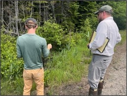 How is the Date Used?This data can also be downloaded for analysis purposes or use in other mapping programs. iMapInvasives allows organizations to create projects and track their own invasive species and treatment data. Account holders can even sign up for alerts on incoming invasive plants to their area of interest! Whether managing invasives on a state level, local level, or even just in your backyard, these tools can help land managers and landowners develop effective management strategies at any scale.Get Started!Anyone can take an active role in the management of invasive species across Maine by using iMapInvasives. To get started, visit www.iMapInvasives.org on a laptop or desktop computer and create a free account.For additional resources and tutorials, visit the Maine Natural Areas Program website. Contact invasives.mnap@maine.gov with any additional questions or concerns.Happy hunting!Learn more: iMapInvasivesMaine State Government is an equal opportunity provider and employer. Manage Preferences & Unsubscribe | Help | Credits | Contact Us How is the Date Used?This data can also be downloaded for analysis purposes or use in other mapping programs. iMapInvasives allows organizations to create projects and track their own invasive species and treatment data. Account holders can even sign up for alerts on incoming invasive plants to their area of interest! Whether managing invasives on a state level, local level, or even just in your backyard, these tools can help land managers and landowners develop effective management strategies at any scale.Get Started!Anyone can take an active role in the management of invasive species across Maine by using iMapInvasives. To get started, visit www.iMapInvasives.org on a laptop or desktop computer and create a free account.For additional resources and tutorials, visit the Maine Natural Areas Program website. Contact invasives.mnap@maine.gov with any additional questions or concerns.Happy hunting!Learn more: iMapInvasivesMaine State Government is an equal opportunity provider and employer. Manage Preferences & Unsubscribe | Help | Credits | Contact Us |
Subscribe to updates from Maine Department of Agriculture, Conservation and Forestry
Email Address
e.g. name@example.com
Share Bulletin


iMapInvasives: Maine’s Invasive Species Tracker : National Invasive Species Awareness Week
Maine Department of Agriculture, Conservation and Forestry sent this bulletin at 02/23/2026 02:00 PM EST
| View as a webpage / ShareInvasive Species Awareness & ActioniMapInvasives: Maine’s Invasive Species TrackerInvasive species are a major threat to ecosystem health and biodiversity in Maine. Once established, invasive species outcompete our native species for habitat and resources. In addition to biodiversity loss, invasive species impact crop and timber yields, water quality, and even reduce property values. It is estimated that invasive species have cost North America over $26 billion annually since 2010 (National Invasive Species Information Center). What is iMapInvasives?To manage the spread of invasive species, land managers must first understand where invasive species are located. iMapInvasives is a web-based mapping tool that allows users to report, track, and monitor invasive species. In Maine, iMapInvasives serves as the central repository for invasive plant data. Free to anyone in the state, iMapInvasives can be an effective tool for citizen scientists, conservation groups, or even landowners managing invasive species on their own private property.Who can use iMapInvasives?Using the iMapInvasives app on a mobile device, anyone in Maine can document and upload records of invasive species anywhere in the state. Plus, accessing this data is easy! By visiting iMapInvasives.org on a desktop browser, anyone can see the distribution of invasive plants across Maine, as well as filtering these records by species, region, treatment status, and much more!How is the Date Used?This data can also be downloaded for analysis purposes or use in other mapping programs. iMapInvasives allows organizations to create projects and track their own invasive species and treatment data. Account holders can even sign up for alerts on incoming invasive plants to their area of interest! Whether managing invasives on a state level, local level, or even just in your backyard, these tools can help land managers and landowners develop effective management strategies at any scale.Get Started!Anyone can take an active role in the management of invasive species across Maine by using iMapInvasives. To get started, visit www.iMapInvasives.org on a laptop or desktop computer and create a free account.For additional resources and tutorials, visit the Maine Natural Areas Program website. Contact invasives.mnap@maine.gov with any additional questions or concerns.Happy hunting!Learn more: iMapInvasivesMaine State Government is an equal opportunity provider and employer. Manage Preferences & Unsubscribe | Help | Credits | Contact Us |
Subscribe to updates from Maine Department of Agriculture, Conservation and Forestry
Email Address
e.g. name@example.com
Share Bulletin
iMapInvasives: Maine’s Invasive Species Tracker : National Invasive Species Awareness Week
Maine Department of Agriculture, Conservation and Forestry sent this bulletin at 02/23/2026 02:00 PM EST
|


